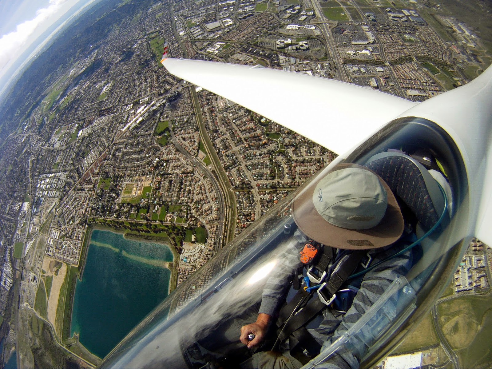
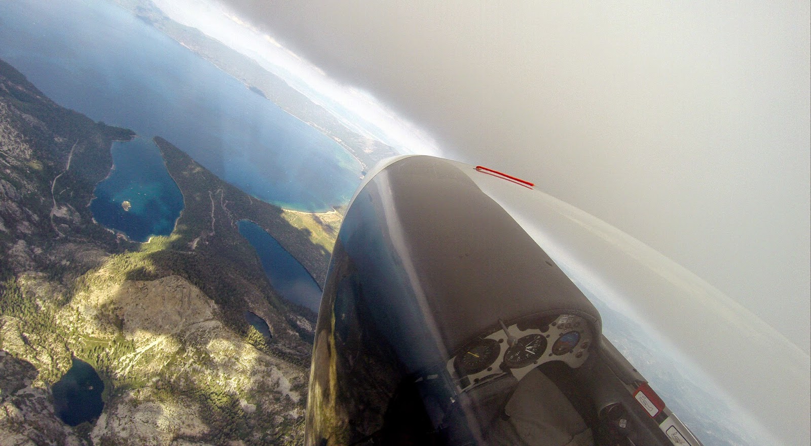
Looking back at 2014 - it was another great soaring year. Although not quiet as many hours and miles as 2013, I managed to cover a lot of ground again, and had few amazing and unforgettable flights.
The traces below are from 59 cross country flights I had in 2014, totaling 18,151 miles (29,211km) and 338 hours, averaging 307 miles per flight. The flights spanned the whole length and width of Claifornia from the Mexican border to Oregon and from the Pacific to Reno, as well as Nevada, Utah, Arizona, Wyoming and Colorado. During those trips I visited 16 airports.
Some of the year highlights:
Broke my last year Byron record with a 775km flight to Warner Springs
Had my longest straight out: 515 miles (828 km) from Tehachapi to Oregon (landed in Lakeview)
Did the first 1000km (1052km) flight from Nephi, UT
Had a total of two flights over 1000km
Won the west zone Henri Comb Trophy with 4 back to back straight out diamond (over 500km) flights during two consecutive weekends.
Had my most amazing soaring adventure: Byron to Warner Springs and back with overnight in San Diego, over 400 miles each direction, without a crew following!
The traces below are just the straight outs this year. While most of it without a crew, I owe my success this year to those who crewed for me or retrieved me: My wife Katia, Terence, Mathew and Jim.
Here is a short write up of the Warner Springs adventure:
On the 2nd weekend of September, Eric Rupp, Morgan Hall and myself had a fantastic weekend flying back to back straight outs from our respective airports, myself from Byron, Eric from Hollister and Morgan from Avenal. We chose Warner Spring as our ultimate goal and made it there and back the next day, without a crew (and without motor).We put our faith on the epic forecast and our ability to pull this off, with up to 5 alternate landings at gliderports along the way where we could get tows if we needed to. The soaring conditions along the coastal ranges and Mojave were so amazing it was actually quiet easy. We spent the night In Escondido, and flew back the next day via Santa Barbara/Santa Ynez area with a 10:30AM launch into strong convergence. Conditions from Warner to Santa Ynez area were fantastic again, but much softer further north making the return more challenging, yet all three of us made it back to our respective airports. A weekend to remember!
Another memorable weekend was the Tehachapi Dust Devil Dash on the 1st September weekend.
My plan was to start from Truckee the prior day by flying straight
out south to Tehachapi, crewless. I didnt quiet made Tehachapi and landed some 20 miles away at California City instead, but thanks to good friends I was soon at Tehachapi and the next day I won 3rd place with my 515 miles straight out to Lakeview, Oregon, thanks to Mathew and Terrence who volunteered to crew from Truckee. I have fond memories of Lakeview from my hang gliding days, so was great to visit this friendly town again and spend the night there.
Some of my favorites photos and video clip from 2014:
The above traces are from 61 Cross Country flights I had in 2013,
totaling 20,438 miles (32,892 km) and 361 hours, averaging 335 miles per flight. The
flights spanned 5 states (California, Nevada, Utah, Arizona, Oregon) and multiple landmarks and National Parks (Mt Shasta, Mt Lassen, Crater Lake, Lake Tahoe, Grand Canyon, Zion Canyon,
Lake Powell, Big Sur) and visited 20 airports (half of them unplanned landouts).
This was another record year - more distance, more hours (and more landouts...) than any prior year.
Some highlights from 2013:
Set New Byron straight out record (600km) to Crystal airport
Flew in wave from Byron to Ukiah and back
Flew straight out wave flight from Byron to San Luis Obispo via Big Sur coast.
Had my longest wave flight - 830km from Williams
My longest and one of my most memorable flight north from Williams to Crater Lake, Oregon and back to Shasta.
Flew from Parowan to the Grand Canyon and back
3 flights over 1000km from Ely during a 5 days period
The above traces are from 64 Cross Country flights I had in 2012, totaling 20,080 miles (32,316 km - the most km flown in the US in 2012 according to OLC) and 370 hours, averaging 313 miles per flight. The flights spanned 6 states (California, Nevada, Utah, Arizona, Idaho,
Oregon) and multiple landmarks and National Parks (Lake Tahoe, Death Valley, Las Vegas, Grand Canyon, Zion Canyon, Cedar Breaks, Escalante, Lake Powell, Canyonlands, Arches National Park (Moab), Golden Gate Bridge, Big Sur, Napa Valley) and visited 11 airports (5 of them unplanned landouts).
This was my best year so far - more distance, more hours and more personal bests than any prior year.
Some highlights from 2012:
Finally completed my Diamond badge and 1000km diploma
Set New Byron distance record (633km) and New Hollister out and return distance (702km)
Flew over San Francisco to Point Reyes and Half Moon bay at 18,000 feet in wave
Got to 25,000 feet in wave over Minden (Lake Tahoe)
Had my longest flight of 1255km olc distance (1051km FAI triangle) from Ely
5 flights of 1000-1250km from Ely during a 10 days period
Captured the PASCO Egg with a flight from Jean (Las Vegas) to Truckee
Flight traces from 3 weeks soaring safari to Ely, Parowan and Jean, spanning 6 states (California, Nevada, Utah, Idaho, Oregon, Arizona) and areas such as Lake Tahoe, Death Valley, Las Vegas, Great Basin National Park, Grand Canyon, Zion Canyon, Cedar Breaks, Escalante, Lake Powell, Canyonlands, Arches National Park (Moab). Total distance flown 5878 miles (9405km). Total flying time 81 hours in 10 flights (averaging 940km and 8 hours per flight).
Out of the 10 flights, 5 were between 1000-1250km, including 2 flights over 1000km FAI triangle and one declared 3TP 1000km which earned me my 1000km diploma.
Below are some photos and a video clip:
16K over Yosemite park within sight of Yosemite valley
Crossing the sierra from Sonora Pass area
I had an interesting flight on Saturday from Truckee. Thanks to Jim
Alton (who also lives in San Ramon) who volunteered to drive my car and
trailer back home if I fly to Byron, I decided to keep this an option
in case I can get high enough over the Sierra crest. My plan was to go
back home Saturday night anyway, so this sounded like an attractive
option. The day started slow though, and I had to struggle to get out of
Truckee, and to get to Patterson where the first clouds started, but
once there, it was relatively straight forward to get to White Mountain
Peak, and to cross from there to the Sierras near Tioga Pass. I got to
near 18K and flew deep over Yosemite park within sight of Yosemite
valley and Half Dome. Still crossing to Byron from there was not a sure
thing, I needed to get further NW first, so followed the clouds over the
Sierra crest to near Sonora Pass, but could only get to 15.5K or so
there, which gave me marginal glide to Byron with 10 knots easterly tail
wind.
There were more clouds further west of the crest,
but they were not giving much, but I managed to gain some on glide also
thanks to the easterly wind. But once over the western slopes of the
Sierra, the 10 knots tail wind turned to 10 knots head wind due to NW
wind aloft, and it stayed that way all the way down to landing. I also
needed to crab some to the north to maintain heading to Byron. My flight
computer did not pick up the change as I was not turning, but I started
loosing on glide to Byron quickly. The only indication I had of the change was
by comparing my ground speed to my TAS. I wonder how many pilots
looking at those 2 numbers side by side in their flight computer? If
your flight computer provides TAS, I highly recommend this method, as it
is the most instantaneously HW/TW info.
Anyway, once I figured how to tell XCSoar that I actually had 10 knots
head wind and not tail wind, most of my margin over Byron was gone, but by now I
was already committed. Of course I had plenty of margin over the Sierra so it was a no stress, 100+ miles glide which took 1.5 hours.
Long story short, I barely made
Byron. Around 20 miles out I
was only 500 over glide, but it didn't look right. The glide angle to
Byron looked much more flat than it should until I realized I
need to adjust for Byron pressure altitude which was 600 feet off! Once
adjusted I
lost all my margin and just had enough for base to final. The vario
never beeped even once since I left the last cloud at around 15K. Still I
managed 40:1
glide with 10 knots head wind and slightly sinking air. Not bad. One
point less in glide and I would have landed short...
I was hoping to
still find pilots at Byron since after all the forecast for the Diablo
Range was great if someone took high tow. And indeed I found Yuliy who
was still working on his glider when I landed around 6:30PM.
Special thanks to Yuliy for the ride home, and to Jim
Alton for driving my car and trailer from Truckee Sunday night.
This
is BTW the second time I fly across the Sierra to Byron, the first time
was nearly 10 years ago from Minden with my old LS4.
Flight is on OLC: http://www.onlinecontest.org/olc-2.0/gliding/flightinfo.html?dsId=2486655
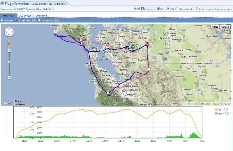
Less than a year after my first Bay Tour, which was almost entirely between 2-4000 feet and below the the floor of class bravo, I repeated the trip, this time way above the 10,000 feet ceiling of class bravo, between 15-18,000 feet. What a spectacular view!
Took off on Saturday January 7 shortly after 11AM and released couple of miles west of Los Vaqueros towers over the red roofs in 1-2 knot wave, which got stronger further up, then moved to the Diablo wave and topped just below 18,000 feet nearly 2 hours after I launched. The wind was mostly from the north 40-50knots. Before the flight I decided that if I can get to near 18K I'll try to repeat my Bay Tour flight, this time way above class bravo instead of below. I calculated that as long as if I can stay above 15,000 feet I can continue safely above class bravo, otherwise I should be able to escape to the side without risking dropping into the airspace below. So once I got to just under 18K near Mt Diablo, I headed west, working multiple wavelets making sure I stay well above the ceiling. I found the next wave over the Oakland Hills, then crossed over the Bay Bridge to Downtown San Francisco and the Golden Gate Bridge where I found the next wave downwind of the Marin Headlands, which got stronger as I got closer to Mt Tamalpais and Stinson Beach. The best wave was over the Pacific, and I continued over the water to Point Reyes where the wave petered out, then turned around and flew back to the Mt Tamalpais wave. Once back to near 18K I went downwind south along the San Francisco coast to Half Moon Bay and La Honda where I encountered strong wave again downwind of the Santa Cruz mountains. It was now after 4PM, with less than an hour left to fly over 40 miles cross wind back to Byron, so I turned east over Mountain view across the bay to Mission peak where I found strong wave again, but no much time left to enjoy it, so pushed the nose down to near VNE, did one last detour to the Diablo Range (Release 1 waypoint) to burn altitude, and back to land at Byron 3 minutes before sunset. Total distance was 322km, almost entirely within glide of Byron! I got below glide back to Byron only once near Point Reyes...
The above traces are from 48 Cross Country flights I had in 2011, totaling
14,630 miles (23,545km) and 290 hours, averaging 305 miles per flight. The flights spanning
8 states (California, Nevada, Utah, Colorado, Arizona, Idaho, New Mexico,
Oregon).
Flight traces from one month soaring safari spanning 6 states (Nevada, Utah, New Mexico, Arizona, Colorado, Idaho) and places such as Zion Canyon, Lake Powell, Wheeler Peak, Monument Valley, Durango, Santa Fe, Sandia Peak. Total distance flown: 6200 miles (10,000km). Total flying time: 96 hours in 14 flights (averaging 442 miles and 7 hours per flight).
Below are some photos and a video clip:
Sometimes it's not all about the distance. Today I had a flight which will be ranked way up there with my most memorable flights. After last weekend flight when I turned over Chabot in the Oakland Hills I made up my mind to try one day to continue this route all the way to the Golden Gate Bridge. This requires a very unusual day, unstable, with reliable lift which can allow safe flying below the 4000 feet floor of class bravo. Today was the day. I made up my mind in the morning to give it a shot and talked Buzz to join me. And indeed, Buzz and myself made it from Byron to the Golden Gate Bridge and some more! We went from Byron to Oakland Hills, Tilden Park, Berkley, crossed the bay just north of the Bay Bridge and the Golden Gate Bridge to Sausalito while staying below class Bravo (and getting as low as 2300 feet over the bay!), over the Ocean to Mt Tam, Navato, Sonoma, Napa, back to Mt Diablo and an unexpected 5 knots wave to 10,000 feet in less than 15 knots wind, then south to the Diablo Range and back to Byron. The view was spectacular and a video will follow. But it wasn't just a spectacular flight, it was over terrain which I never flown before (and I wonder if any glider flown this route before), and it was the first time I flew with another glider (BG) from takeoff to landing without loosing sight of each other for the whole flight. I doubt any of us would have attempted it alone, but flying together is easier, more fun and more encouraging.
The above traces are from 62 Cross Country flights I had in 2010, totaling 18,673 miles and 348 hours, averaging 300 miles per flight. The flights spanning 8 states (California, Nevada, Utah, Colorado, Arizona, Idaho, Montana, Wyoming).