Wednesday, August 22, 2012

2012 Soaring Safari - 7/1-7/22


Flight traces from 3 weeks soaring safari to Ely, Parowan and Jean, spanning 6 states (California, Nevada, Utah, Idaho, Oregon, Arizona) and areas such as Lake Tahoe, Death Valley, Las Vegas, Great Basin National Park, Grand Canyon, Zion Canyon, Cedar Breaks, Escalante, Lake Powell, Canyonlands, Arches National Park (Moab). Total distance flown 5878 miles (9405km). Total flying time 81 hours in 10 flights (averaging 940km and 8 hours per flight).
Out of the 10 flights, 5 were between 1000-1250km, including 2 flights over 1000km FAI triangle and one declared 3TP 1000km which  earned me my 1000km diploma.
Below are some photos and a video clip:

Zion Canyon, UT

Zion Canyon, UT

Zion Canyon, UT

Grand Canyon North Area

Grand Canyon North Area

CanyonLands

Moab/Arches National Park

Canyonlands

Wednesday, June 20, 2012

Truckee to Byron via White Mountain Peak and Yosemite

16K over Yosemite park within sight of Yosemite valley
Crossing the sierra from Sonora Pass area
 I had an interesting flight on Saturday from Truckee. Thanks to Jim Alton (who also lives in San Ramon) who volunteered to drive my car and trailer back home if I fly to Byron, I decided to keep this an option in case I can get high enough over the Sierra crest. My plan was to go back home Saturday night anyway, so this sounded like an attractive option. The day started slow though, and I had to struggle to get out of Truckee, and to get to Patterson where the first clouds started, but once there, it was relatively straight forward to get to White Mountain Peak, and to cross from there to the Sierras near Tioga Pass. I got to near 18K and flew deep over Yosemite park within sight of Yosemite valley and Half Dome. Still crossing to Byron from there was not a sure thing, I needed to get further NW first, so followed the clouds over the Sierra crest to near Sonora Pass, but could only get to 15.5K or so there, which gave me marginal glide to Byron with 10 knots easterly tail wind.
There were more clouds further west of the crest, but they were not giving much, but I managed to gain some on glide also thanks to the easterly wind. But once over the western slopes of the Sierra, the 10 knots tail wind turned to 10 knots head wind due to NW wind aloft, and it stayed that way all the way down to landing. I also needed to crab some to the north to maintain heading to Byron. My flight computer did not pick up the change as I was not turning, but I started loosing on glide to Byron quickly. The only indication I had of the change was by comparing my ground speed  to my TAS. I wonder how many pilots looking at those 2 numbers side by side in their flight computer? If your flight computer provides TAS, I highly recommend this method, as it is the most instantaneously HW/TW info. Anyway, once I figured how to tell XCSoar that I actually had 10 knots head wind and not tail wind, most of my margin over Byron was gone, but by now I was already committed. Of course I had plenty of margin over the Sierra so it was a no stress, 100+ miles glide which took 1.5 hours.
Long story short, I barely made Byron.  Around 20 miles out I was only 500 over glide, but it didn't look right. The glide angle to Byron looked much more flat than it should until I realized I need to adjust for Byron pressure altitude which was 600 feet off! Once adjusted I lost all my margin and just had enough for base to final. The vario never beeped even once since I left the last cloud at around 15K. Still I managed 40:1 glide with 10 knots head wind and slightly sinking air. Not bad. One point less in glide and I would have landed short...
I was hoping to still find pilots at Byron since after all the forecast for the Diablo Range was great if someone took high tow. And indeed I found Yuliy who was still working on his glider when I landed around 6:30PM.
Special thanks to Yuliy for the ride home, and to Jim Alton for driving my car and trailer from Truckee Sunday night. 
This is BTW the second time I fly across the Sierra to Byron, the first time was nearly 10 years ago from Minden with my old LS4.
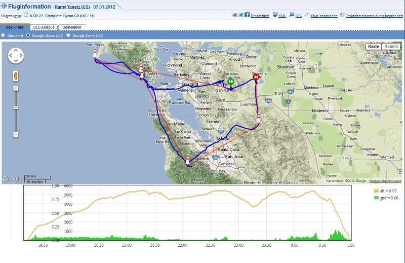
Flight is on OLC:  http://www.onlinecontest.org/olc-2.0/gliding/flightinfo.html?dsId=2486655


Ramy

Tuesday, January 10, 2012

Bay Tour - the sequel


Less than a year after my first Bay Tour, which was almost entirely between 2-4000 feet and below the the floor of class bravo, I repeated the trip, this time way above the 10,000 feet ceiling of class bravo, between 15-18,000 feet. What a spectacular view!
Took off on Saturday January 7 shortly after 11AM and released couple of miles west of Los Vaqueros towers over the red roofs in 1-2 knot wave, which got stronger further up, then moved to the Diablo wave and topped just below 18,000 feet nearly 2 hours after I launched. The wind was mostly from the north 40-50knots. Before the flight I decided that if I can get to near 18K I'll try to repeat my Bay Tour flight, this time way above class bravo instead of below. I calculated that as long as if I can stay above 15,000 feet I can continue safely above class bravo, otherwise I should be able to escape to the side without risking dropping into the airspace below. So once I got to just under 18K near Mt Diablo, I headed west, working multiple wavelets making sure I stay well above the ceiling. I found the next wave over the Oakland Hills, then crossed over the Bay Bridge to Downtown San Francisco and the Golden Gate Bridge where I found the next wave downwind of the Marin Headlands, which got stronger as I got closer to Mt Tamalpais and Stinson Beach. The best wave was over the Pacific, and I continued over the water to Point Reyes where the wave petered out, then turned around and flew back to the Mt Tamalpais wave. Once back to near 18K I went downwind south along the San Francisco coast to Half Moon Bay and La Honda where I encountered strong wave again downwind of the Santa Cruz mountains. It was now after 4PM, with less than an hour left to fly over 40 miles cross wind back to Byron, so I turned east over Mountain view across the bay to Mission peak where I found strong wave again, but no much time left to enjoy it, so pushed the nose down to near VNE, did one last detour to the Diablo Range (Release 1 waypoint) to burn altitude, and back to land at Byron 3 minutes before sunset. Total distance was 322km, almost entirely within glide of Byron! I got below glide back to Byron only once near Point Reyes...
Flight trace

16,000 feet over Downtown San Francisco

San Francisco

15,000 feet over Point Reyes

Point Reyes

17900 feet over the Pacific

The Golden Gate Bridge from near 18,000 feet

Over Mountain View on final glide to Byron